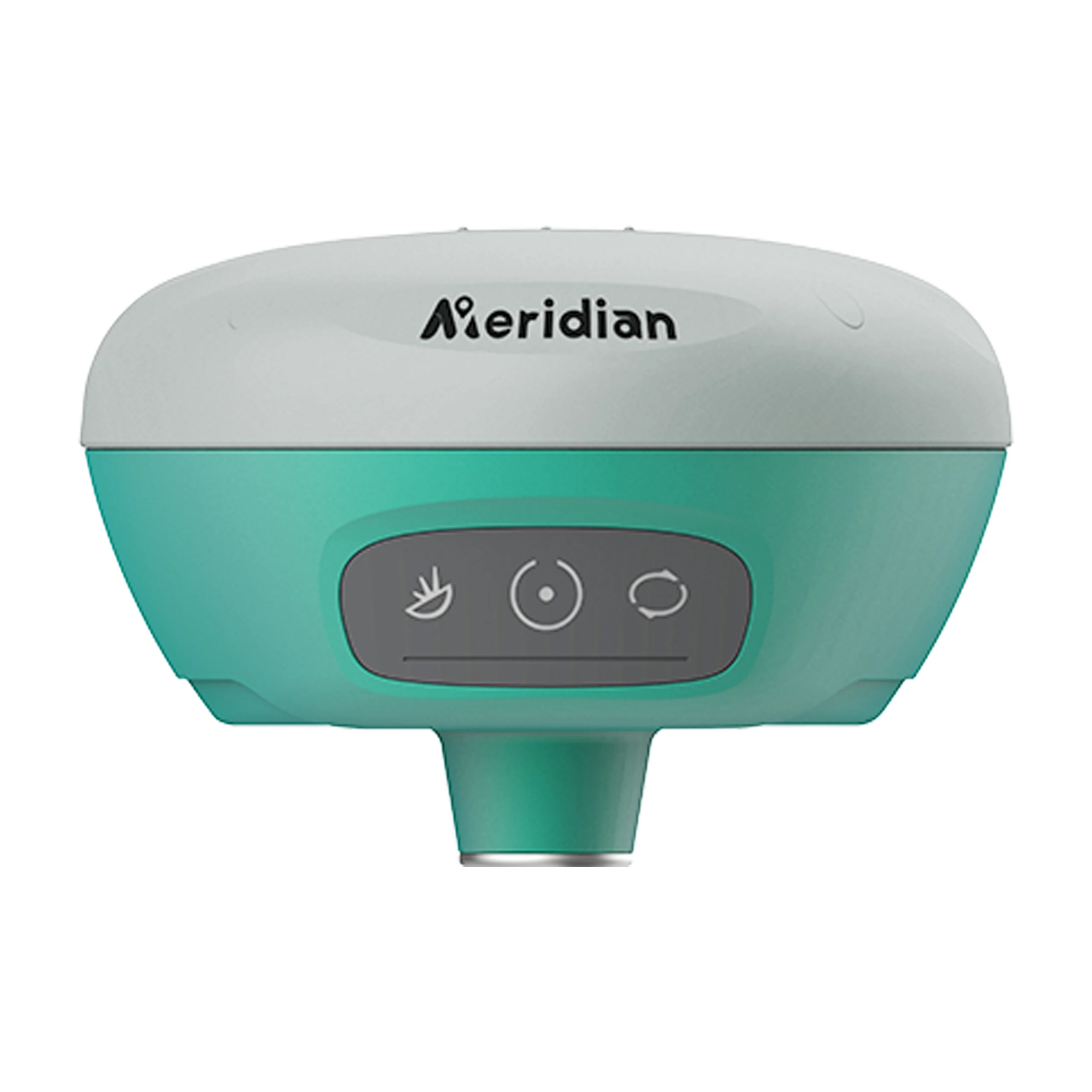

M6 GNSS Receiver
Stoc epuizat
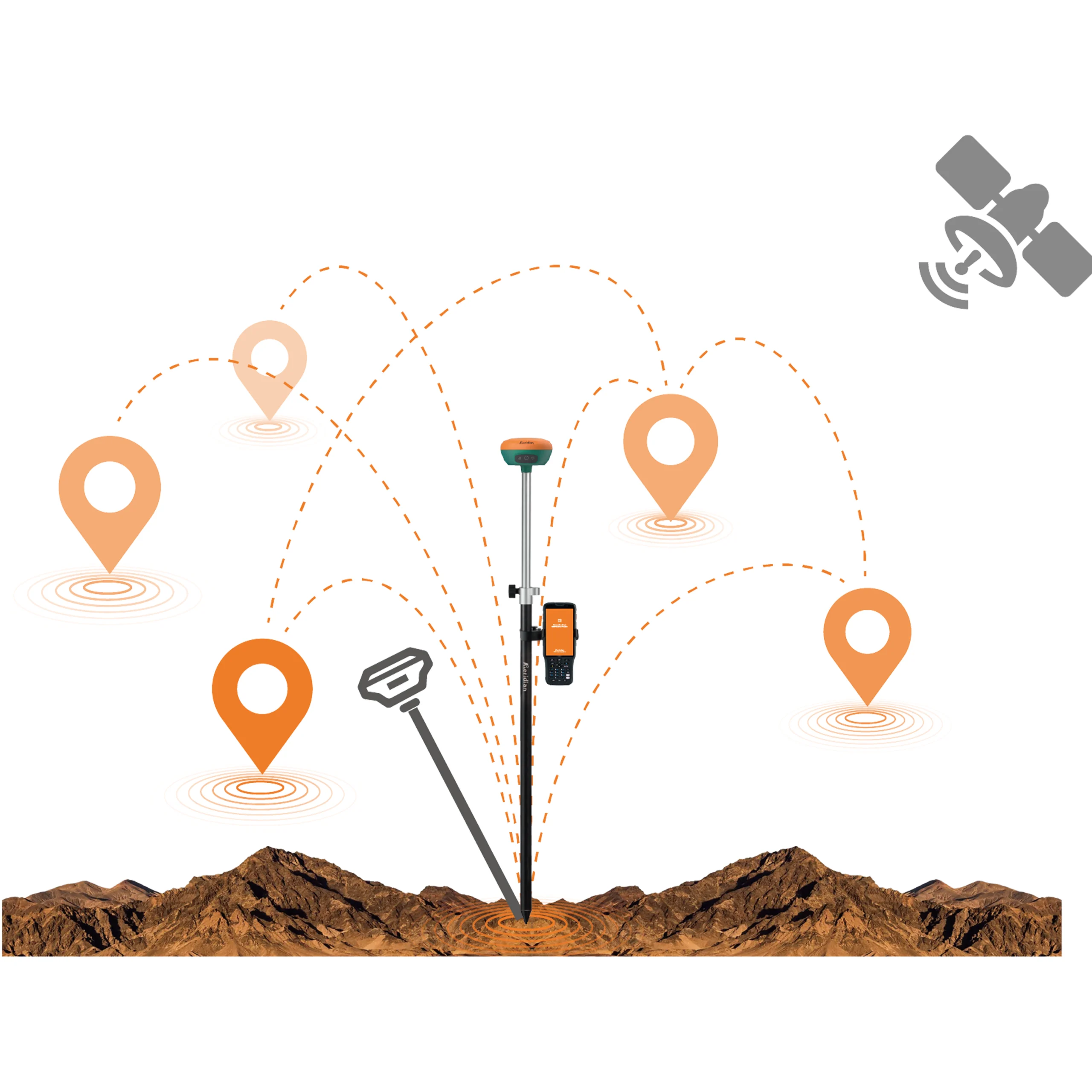
Receptorul Meridian M6 GNSS RTK este soluția supremă pentru poziționarea de înaltă precizie în orice mediu, aduce performanțe superioare și eficiență ridicată pentru a vă sprijini munca de teren cu soluții fiabile. Cu tehnologia sa avansată, M6 oferă o precizie și fiabilitate la nivel de centimetri, chiar și în condiții dificile. Urmărirea constelațiilor multiple și a frecvenței, motorul RTK puternic, tehnologia IMU de compensare a înclinării fără calibrare face ca receptorul M6 să fie ușor de obținut soluție fixă în cele mai solicitante medii, vă aduce să vă concentrați asupra împrejurimilor și nu asupra balonului pentru a măsura punctele care anterior nu puteau fi măsurat, făcându-vă miza mai eficient și mai convenabil decât oricând, cu viteză, siguranță și confort sporite și îmbunătățind considerabil eficiența de lucru
Mai multă portabilitate
Receptorul Meridian M6 GNSS RTK oferă soluții fiabile pentru lucrul pe teren cu performanțe superioare și eficiență ridicată. Motorul său RTK avansat și IMU de nouă generație au ca rezultat o îmbunătățire cu 25% a performanței, chiar și în cele mai dificile medii. Acest lucru face din Meridian M6 un instrument de încredere pentru creșterea productivității.
Greater Flexibility
With its self-developed built-in IMU and corealgorithm, it can deliver precise and dependable outcomes, thus enhancing the efficiency of fieldwork.
Acuratețe și precizie mai mare
Utilizarea antenei cu patch de înaltă performanță îmbunătățește capacitatea de a urmări sateliții la unghiuri de altitudine scăzută, menținând în același timp un câștig ridicat pentru sateliții de altitudine mai mare.
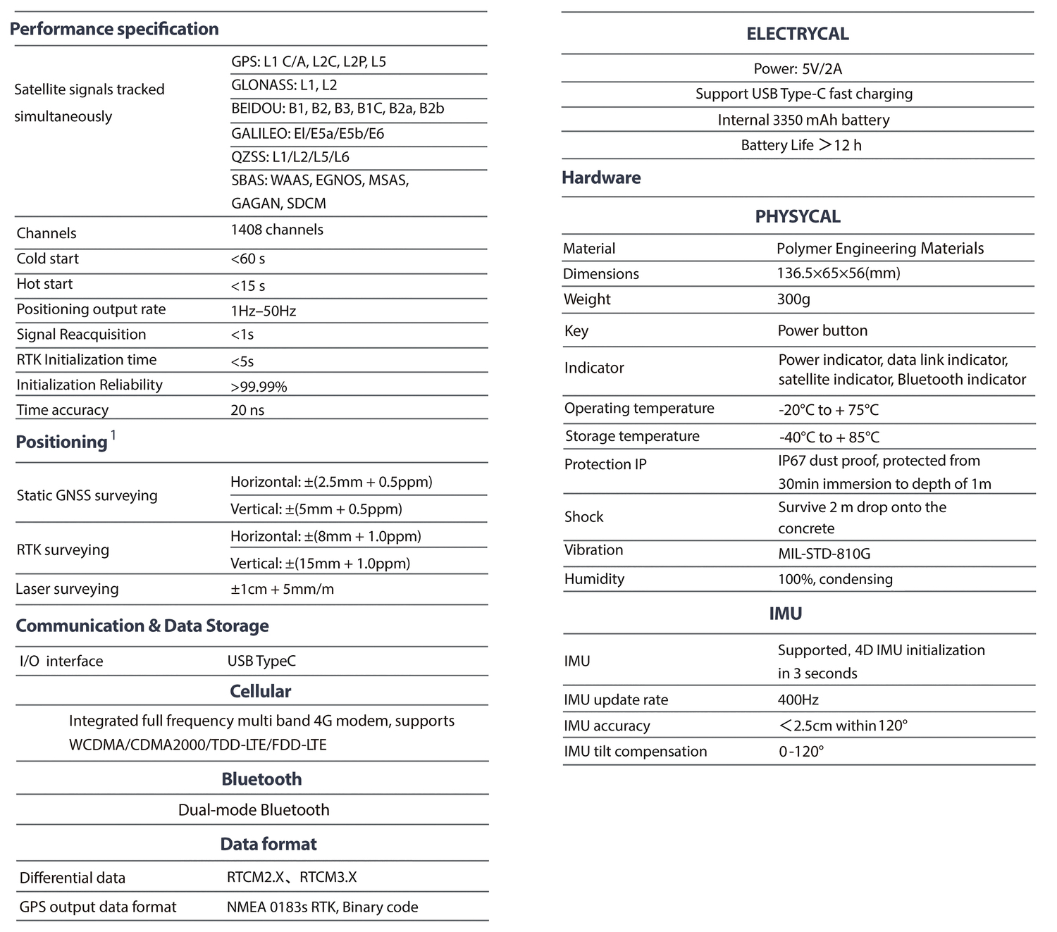
Technical Specification
| GNSS Signal② | Channels | 1408 |
| GPS | L1C/A,L1C,L2P(Y),L2C,L5 | |
| BDS | L1,L2,L3* | |
| GLONASS | B1I,B2I,B3I,B1C,B2a,B2b* | |
| GALILEO | E1,E5a,E5b,E6* | |
| IRNSS | L1,L2,L5,L6* | |
| QZSS | L1,L2,L5 | |
| SABS | L5 | |
| L-Band | B2b PPP (Only for the Asian-Pacific Region) | |
| Positioning Performance |
High-precision static GNSS Surveying | Horizontal: 2.5mm + 0.1ppm RMS | Vertical: 3.5mm + 0.4ppm RMS |
| Static and Fast Static | Horizontal: 2.5mm + 0.5ppm RMS | Vertical: 5mm + 0.5ppm RMS | |
| Post Processing Kinematic (PPK / Stop & Go) |
Horizontal: 8mm + 1ppm RMS | Vertical: 15mm + 1ppm RMS | |
| Initialization time: Typically 10 min for base and 5 min for rover | ||
| Initialization reliability: Typically>99.9% | ||
| Code Differential GNSS Positioning | Horizontal: ±0.25m+1ppm RMS | |
| Vertical: ±0.5m+1ppm RMS | SBAS: 0.5m (H), 0.85m (V) | ||
| Real Time Kinematic (RTK) | Horizontal: 8mm+1ppm RMS | Vertical: 15mm+1ppm RMS | |
| Initialization time: Typically <10s | Initialization reliability: Typically > 99.9% | ||
| Time to first Fix | Cold start: < 45 s | Hot start: < 30 s | Signal re-acquisition: < 2 s | |
| M-Fix① | Horizontal: RTK+10mm / minute RMS | Vertical: RTK+20mm / minute RMS | |
| Tilt Survey Performance | Additional horizontal pole-tilt uncertainty typically less than 8 mm +0.7 mm / °tilt (2.5cm accuracy in the inclination of 60°) |
|
| Communication | Communication | Bluetooth: 4.2 / 2.1+EDR, 2.4GHz |
| Wi-Fi: frequency 2.4GHz, Supports 802.11 b / g / n | ||
| Internal UHF Radio | Frequency: 410-470MHz | Channel: 116 (16 scalable) | |
| Transmitting power: 0.5W / 1W / 2W adjustable | ||
| Supports multi-communication protocols:TRIMTALK450ST,CHC, HI-TARGET, TRIMMARK III, TRANSEOT, SOUTH 9600, SOUTH 19200 |
||
| Physical | Internal battery | Internal 7.4V / 6800mAh lithium-ion rechargeable battery |
| RTK Rover (Network) for 12 hours | Static: up to 15 hours | ||
| External power | Power consumption: 4.2W | Dimensions (W×H): 132mm×67mm | |
| Charging: using standard smartphone chargers or external power banks | ||
| Weight: ≤0.8kg (includes battery) | Data storage: 8GB ROM internal storage | ||
| Control Panel | LED Lamp | Satellite, Signal, Power |
| Physical button | 1 | |
| Environment | Water / Dustproof | IP68 |
| Shock and vibration | Designed to survive a 2m natural fall onto concrete | |
| Humidity | 100%, condensing | |
| Operation temperature | -30℃~+70℃ | |
| Storage temperature | -40℃~+80℃ | |
| I / O Interface | 1 × USB port, Type C | |
| 1 × SMA antenna connector | ||
| Data Formats | Output rate | 1Hz-20Hz. |
| Static data format | GNS, Rinex | |
| Network model | VRS, FKP, MAC; supports NTRIP protocol | |
| CMR& RTCM | CMR, RTCM 2.x, RTCM 3.0, RTCM 3.2 | |
| Navigation outputs ASCII | NMEA-0183 | |
| 1. *Description and Specifications are subject to change without notice. | ||
| 2. *BDS B2b, GALILEO E6, QZSS L6, IRNSS L5 will be provided through future product upgrade. | ||
Bazată pe 0 recenzii
Fi primul care adaugă o recenzie pentru “M6 GNSS Receiver”
Produse similare
-
Receptoare GPS-GNSS
AlphaGeo GeoPuls GNSS RTK
GeoPuls este un instrument RTK nou-nouț cu funcție laser. Aspectul său este îndrăzneț și inovator, iar performanța sa este excelentă. Pe baza experienței generației anterioare de echipamente laser, am făcut mai multe îmbunătățiri, inclusiv calibrarea mai frecventă și utilizarea laserului verde pentru a rezolva problema greutății de a viza în lumină puternică. Într-un sens real, realizează măsura unde țintiți și înlocuirea stâlpului în metoda tradițională de măsurare. Cu toate acestea, suntem compatibili și cu modul stâlp, care permite măsurarea cu laser să fie utilizată chiar și atunci când este utilizat stâlpul. GeoPuls este un produs de care topografii chiar au nevoie.
Tehnologie la nivel militar
Tehnologia de procesare la nivel militar, compatibilitatea electromagnetică completă și tehnologia de ecranare, minimizează interferențele electromagnetice ale sistemului și asigură date și rezultate de observație de înaltă calitate.
Multi constelație
GeoPuls, cu 1408 canale, chipset-ul complet GNSS de nouă generație, de a suporta mai multe constelații de sateliți, inclusiv GPS, GLONASS, BEIDOU, GALILEO, OZSS,SBAS și IRNSS oferă date spațiale precise și precise pentru toți utilizatorii din întreaga lume.
Senzor de înclinare IMU
GeoPuls este echipat cu o unitate de măsurare inerțială (IMU) cu inițializare rapidă, fără calibrare și imună la interferența magnetică. Toți utilizatorii pot folosi această tehnologie pentru a colecta sau a trasa puncte de top
până la 120°.
Topografie cu laser
Tehnologia de calibrare rapidă de măsurare a coordonatelor laser patentată exclusivă la nivel mondial poate obține cu ușurință acuratețe de măsurare la nivel de centimetru, făcând măsurarea mai precisă și mai ușor de utilizat. Pe langa modulul laser verde utilizat in echipament, depaseste dificultatea de a viza sub lumina soarelui, facand operatiile de masurare pe teren mai rapide si mai eficiente.
Bluetooth cu mod dublu
Acceptă funcționarea cu Rată de bază și Rată de date îmbunătățită a Bluetooth tradițional și, de asemenea, acceptă cel mai recent standard de putere redusă, SPP3.0+ble5.0 de mare viteză industrială dual-mod, potrivit pentru Android/ISO/PC.
GSM
O conexiune rapidă la internet este garantată cu un modul 4G încorporat care accelerează primirea datelor de corecție folosind toate semnalele și benzile de telecomunicații.
IP67
Măsurat strict IP67, rezistent la apă și praf, robust și durabil, complet potrivit pentru medii în aer liber dure.
 SKU: n/a
 -
Receptoare GPS-GNSS
AlphaGeo NetBOX2
– O nouă generație compactă de laser inteligent AR RTK
– Conceput pentru orice proiect de topografie folosind cea mai recentă tehnologie GNSS
– Este echipat cu toate modulele moderne de conectivitate necesare: Bluetooth, radio intern, modem WIFI & 4G
– Baterie încorporată de 6800 mAh, tehnologia de înclinare IMU și WebUl
SKU: n/a


Nici o recenzie.